Photo: Brunost16 / Wikimedia Commons · CC BY-SA 4.0 · resized and converted
About This Hike
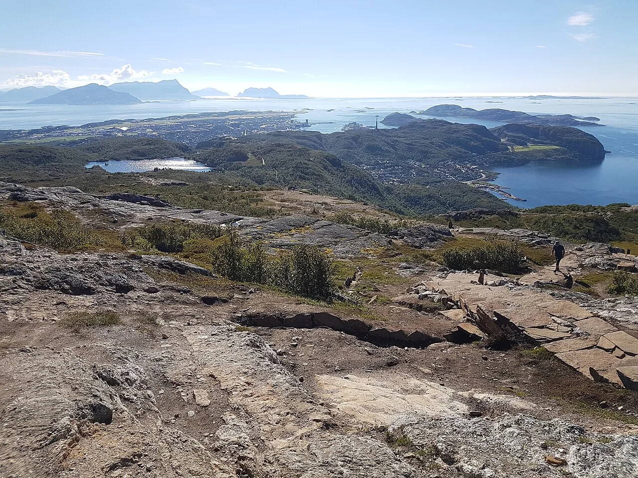
Keiservarden is Bodø's best-known local summit: a cairn at 366 metres on Veten above Rønvikfjellet, renamed after Kaiser Wilhelm II visited in 1889. Choose the start before comparing difficulty or distance. The signed Keiserstien from the Rønvikfjellet car park combines gravel road, trail and Sherpa-built stone steps; Visit Bodø grades it moderate and lists 5.5 kilometres and 2.5 hours return. A loop is possible by descending the gravel road and crossing back to Keiserstien on the marked connection near Kretjønna. The longer alternative from Maskinisten follows Natoveien, a broad gravel road with sustained steep sections that Bodø municipality says can suit a pram in appropriate conditions. From the Rønvikfjellet side, keep left at Svartvatnet because the right-hand path is affected by landslide risk. The exposed summit has a direction plate identifying the Lofoten Wall, Helgeland coast and border mountains towards Sweden. Kværmannsbu offers roofed seating nearby, but it is an open shelter rather than a heated hut. In winter, do not assume the road has been cleared; use traction and lighting suited to the actual surface and daylight.
Highlights
- ✓ A 366 m summit reached in about an hour, with the Lofoten wall, the Helgeland coast and the border mountains all visible from one point
- ✓ Sherpa-built stone stairs on the upper section, with benches placed at the viewpoints
- ✓ Two lean-to shelters on the route, at Svartvatnet and at the summit itself
- ✓ A directional plate at the cairn naming the surrounding peaks with their distances and heights
Getting There
Rønvikfjellet car park, reached via Fv834 and the hairpins of Fjellveien, about 3.5 km from Bodø centre. A longer approach starts at Maskinisten (bus 3): 7.8 km round trip, 313 m of ascent, April to November. Fees not published.
Municipality: Bodø, Nordland
Before You Go
The published distance and walking time vary with the chosen approach, so do not mix the shorter Rønvikfjellet route with the longer Maskinisten approach when planning your day. In wet, icy or windy weather, the easier-looking gravel-road option can be the more sensible choice; confirm local conditions and follow current signs near Svartvatnet rather than relying on an older track.
Information checked: September 2026 against Bodø municipality and Visit Bodø route information.
⚠️ Safety Notes
- The summit plateau is exposed and coastal; wind, driving rain and rapid visibility loss are common even when it is calm in town
- The route is walkable year-round, but the stone stairs and rock slabs are slippery when wet, icy or snow-covered — use spikes outside summer
- This is a far northern hike: daylight is very short from late November to mid-January, so carry a headtorch and check sunset times
- The longer approach from Maskinisten is 7.8 km round trip with 313 m of ascent and is listed as an April-November route; choose your start point deliberately
- There is no water source on the upper section, and the shelters are open lean-tos rather than enclosed huts