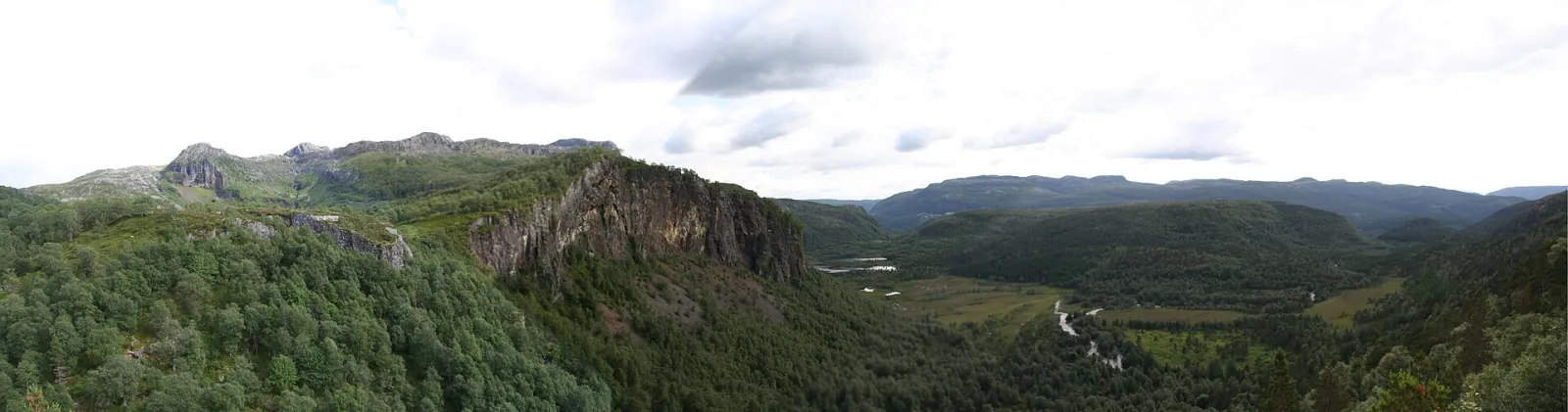
Photo: Arne Østensen / Wikimedia Commons · CC BY-SA 3.0 · resized and converted
About This Hike
Ritlandkrateret in Vormedalen, Hjelmeland, is a meteorite impact structure about 2.7 kilometres across, formed roughly 500 million years ago. The signed outing begins at Kleivaland and forms a loop of about 6–7 kilometres to a gapahuk shelter overlooking the crater. Hjelmeland municipality describes roughly one hour of walking each way, while a more detailed municipal route note recommends allowing four to five hours. A useful plan is therefore about two hours of actual walking and three to four hours for the complete loop, interpretation and breaks. After the first forest climb, the northern branch signed “Utsikt Ritlandskrater” follows tractor road for most of the approach. The southern branch, signed toward Melands Grønahei, uses forest path and boggy ground before a shorter, steeper climb; using one branch in each direction creates the loop. There are 318 vertical metres between its lowest and highest points. At the shelter, signs explain the impact and the prominent escarpment across the crater. The area contains Rogaland's only known fossil-bearing bedrock. Bring footwear for mud, carry food and water, and leave fossils, stones and other geological material undisturbed.
Highlights
- ✓ A gapahuk shelter set as a viewpoint over the crater floor, with interpretive signage about the impact
- ✓ A 2.7 km impact structure formed roughly 500 million years ago
- ✓ The 400-metre escarpment of marine clay at the far end of the crater
- ✓ Rogaland's only known fossil-bearing bedrock
- ✓ A gentle, mostly tractor-road approach to an interpretation shelter
Getting There
Kleivaland in Vormedalen, car park with information board. From Rv13 to Hjelmeland, follow Vormedalsvegen to Laugaland and the signs to Kleivaland. Fees not published.
Municipality: Hjelmeland (Ryfylke), Rogaland
Trailhead: 59.239930, 6.380900 · Open in Google Maps
Before You Go
Use the 6-7 km Kleivaland loop as the defined crater visit: the northern route to the shelter is mostly tractor road, while the southern route has more forest path and boggy ground. Both take about an hour each way. Do not confuse this loop with the longer Stavanger Trekking Association routes beyond the crater area; those need their own map and a fuller day.
Information checked: September 2026, against current Hjelmeland municipality Ritlandkrateret route and visitor information
⚠️ Safety Notes
- The direct route is mostly on tractor road in easy terrain, but conditions can still be slippery in winter or after heavy rain
- Use the signed Kleivaland parking and follow the route to the shelter; longer Stavanger Trekking Association routes are separate day plans
- View the escarpment from a safe distance and keep children close near uneven ground
- Leave geology and fossils where they are so other visitors can experience the site