About This Hike
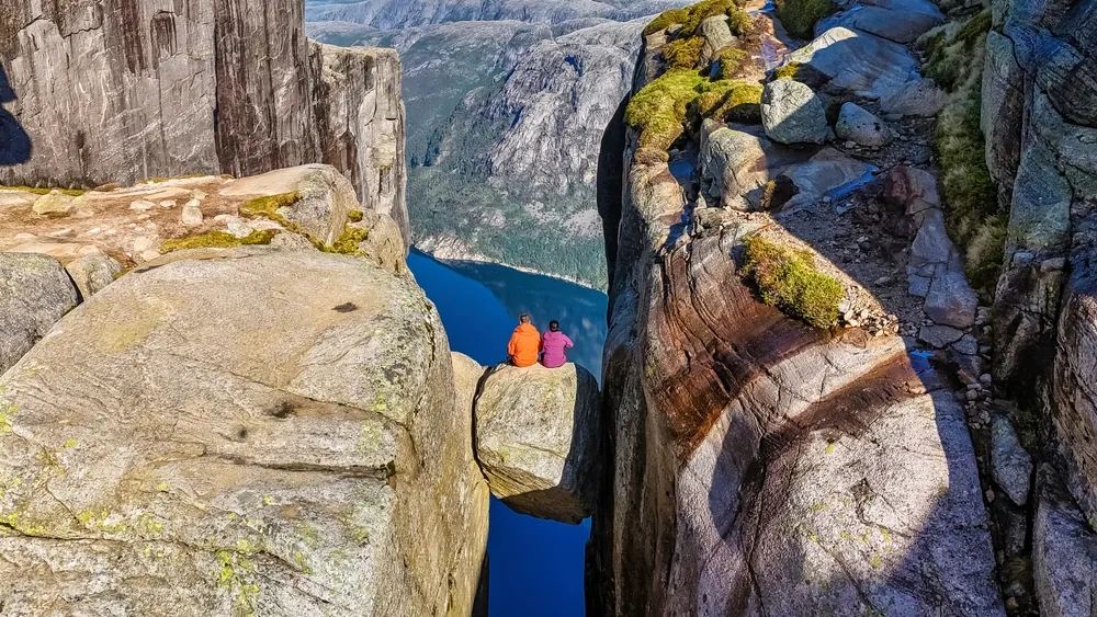
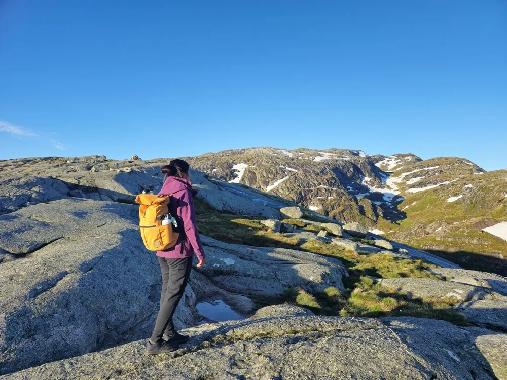
Kjerag is a demanding mountain day above Lysefjorden, best known for Kjeragbolten, the boulder wedged in a crevice roughly 1,000 metres above sea level. The marked return route starts at Øygardstøl, also called the Eagle's Nest, and covers 11 kilometres over three steep hills separated by shallow valleys, with 750 metres of total ascent. Allow five to six hours in good conditions and more for wet rock, queues or a slower group. Chains and railings assist on steep granite, but they do not remove the need for secure footing or upper-body confidence, especially during the descent. Storedalen is the stated place to refill water before the exposed plateau. Near the destination, Nesatind lies shortly before Kjeragbolten and provides a broad fjord viewpoint without requiring anyone to step onto the boulder. Standing on Kjeragbolten is entirely optional and unprotected. Check the daily trail update at the staffed parking area, start early enough to return in daylight, and remember that camping or sleeping in vehicles is prohibited at Kjerag Parking.
Highlights
- ✓ Kjeragbolten wedged roughly 1,000 m above Lysefjorden
- ✓ The broad Nesatind viewpoint before the boulder
- ✓ Three steep hills with chain- and railing-assisted granite sections
- ✓ Views across the 42 km-long Lysefjorden from the Kjerag massif
Getting There
Paid parking, toilets and staffed tourist information are at Øygardstøl/Kjerag parking. In summer, Lysebotn has a shuttle connection to the trailhead and an express-bus option runs from Stavanger; check and book the current service directly before travelling.
Before You Go
The stated 11 km, 750 m and five-to-six-hour figures are the return trip from Øygardstøl. Kjeragbolten is optional: Nesatindane, roughly 300 m beforehand, provides a broad fjord view without stepping onto the boulder. Confirm the current trail update at the parking information point before starting; do not plan to camp or sleep in a vehicle at Kjerag Parking.
Information checked: September 2026, against Lysefjorden 365's current Kjerag route and parking guidance
⚠️ Safety Notes
- Kjeragbolten is high above Lysefjorden; a fall would be fatal. Do not feel pressured to step onto the boulder, and keep well back from exposed edges.
- The exposed plateau is prone to sudden strong wind gusts, so stay well back from edges and do not hike when strong wind, heavy rain or fog is forecast.
- The route crosses three steep hills and includes chain-assisted sections on the steepest ground. It requires good fitness and confidence on rough mountain terrain.
- Do not set out when strong wind, heavy rain or fog is forecast; rain can make the trail slippery. When snow remains on the route, local guidance recommends an experienced guide rather than hiking independently.
- Fill your bottle at Storedalen, which is the stated refill point on the route, and bring enough food, warm waterproof layers and a fully charged phone.
- Start early enough to return in daylight, do not rely only on mobile mapping, and allow extra time if there are queues near Kjeragbolten.
- Outside the main season, the road and trail infrastructure may be closed or removed. Check local conditions and use an experienced guide if conditions require it.